

with more than 20 years in the industry, Geoplan 3D has gained broad experience and good routines for most types of surveying assignments. We have extensive experience in connection with construction, transportation developments and building projects. Geoplan 3D also has extensive experience with industrial surveying and cultural-historical documentation.
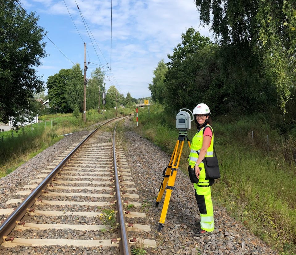
Fixed survey marks and reference networks are the starting point for all surveying we do. The reference network enables the measurement of coordinate-based location in construction drawings and height in relation to known geodetic reference systems.
We perform precision leveling and settlement control for all types of buildings, dams, bridges, and more. The measurements are carried out with instruments that provide the necessary precision for the project.
We provide all types of surveying work related to building and construction projects. Everyday
assignments for Geoplan 3D include the creation of axis,
geometric controls, the measurement for «As-built»,
(FKB / NVDB) and production of terrain models.
Measurement and documentation for water and sewerage systems. 3d models of entire treatment plants and water treatment plants. Manhole registration both as a traditional manhole card and 3d-models.
We perform surveying engineering, outlining measures, and location control. Geoplan 3D can contribute to all types
building from application for start-up permit to completion certificate.
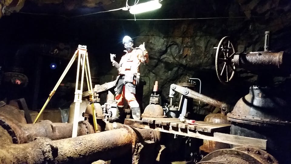
We perform all types of terrain models, measuring existing structures, tunnels, bridges. We specialize in surveying and
drawing / 3d modeling of existing buildings, industrial facilities, etc.
Good quality assurance means that we can achieve that the end product meets all requirements for quality.
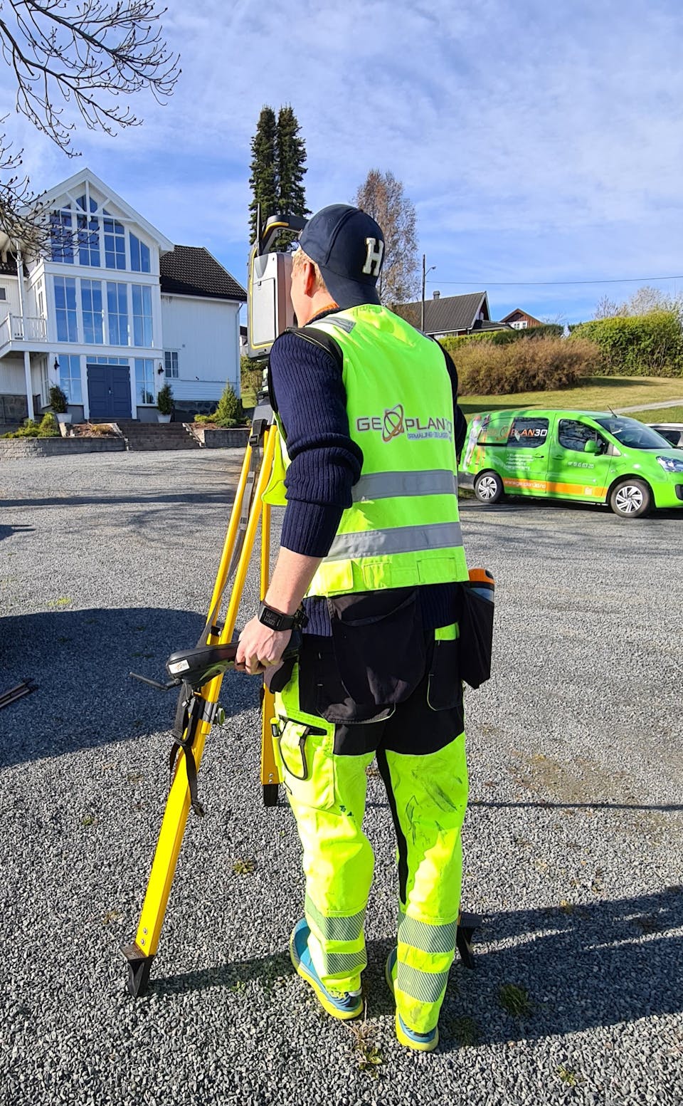
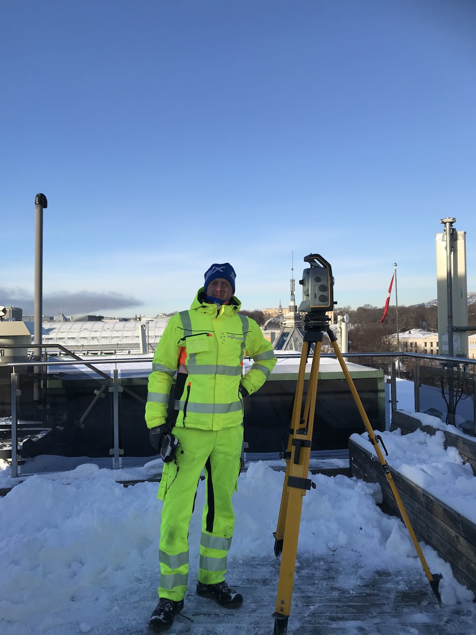
Our surveyors use the latest in total stations and GNSS equipment (GPS). We have service agreements on all equipment that is in daily use to ensure accuracy, reliability, and productivity. We only use surveying equipment from reputable brands such as Trimble and Leica Geosystems.
Collegial camaraderie and flexible working hours mean that we can follow up the project from beginning to end, which gives a surveyor security and which satisfies the customer.
Survey marks and Reference networks are the starting point for all surveys we carry out. The basic network enables measurement and coordinate-based location in floor plan and height in relation to known geodetic reference systems. The basic network we create is used as a foundation for surveying tasks, geodata, mapping, and property surveying, as well as for sticking planned objects in the terrain. Geoplan 3D always has an open dialogue with the customer about how the basic network will be established and which measurement methods will be most appropriate for the project.
For this type of measurement, we use techniques such as static measurement with GNSS (GPS), total station, polygon drag, and levels. Our deliveries undergo a quality control with a checklist in accordance with current regulations before it is delivered to the customer.
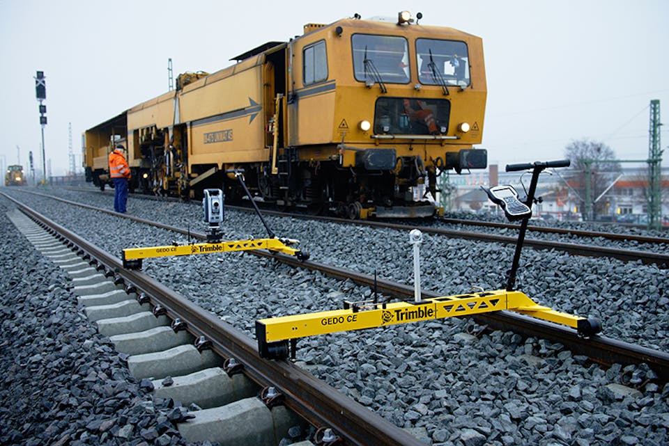
We perform precision leveling and
settling control for all types of buildings, roads, railways,
bridges, construction sites, and more. The measurements are carried out with instruments that provide the necessary accuracy for the project. Geoplan 3D maintains a close dialogue with the customer regarding the location of measurement points and the execution of the assignment. We deliver measurement data in a format that can be imported into the customer's GIS solution. We also carry out civil settlement notifications near the project.
We carry out all types of survey work within construction, transportation, and construction projects. Our survey engineers have broad experience from various projects and you can expect professionalism from us.
• Stakeout for production - Construction, road and railway
• profiling for terrain models
• Stakeout for design and planning
• axis stakeout
• geometric controls
• measurement control "as-built"
• Measurement for FDV, NVDB and FKB

We carry out Surveying and documentation for water and waste plants. 3D models of entire wastewater treatment plants and water treatment plants. Manhole registration both as traditional manhole-card and 3d model.
For such assignments, we use traditional surveying, photogrammetry, and scanning. We can produce WaW models that reproduce infrastructure between manholes in a defined area.
We carry out surveying stakeout and location control for all kinds of construction. New construction typically requires stakeout for building foundations, columns, pavement, curbs and utilities. We take the engineered design plans, architectural drawings, and structural drawings of the site and building and compute the coordinated location of these improvements.
Geoplan 3D has central approval in action class 3 and can contribute to all types of buildings from application for commissioning permit to completion certificate.
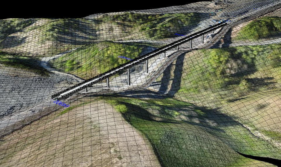
We carry out all types of terrain models, measuring existing structures, tunnels, bridges, etc. We specialize in measuring and drawing / 3d modeling of existing buildings, industrial plants etc.